File:LostProvinceLocal4 1024.jpg
Size of this preview: 424 × 600 pixels. Other resolution: 724 × 1,024 pixels.
Original file (724 × 1,024 pixels, file size: 219 KB, MIME type: image/jpeg)
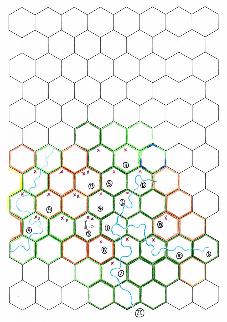
Lost Province local map of Cogistan and the western Gaur River region as at 19/7/2015
File history
Click on a date/time to view the file as it appeared at that time.
| Date/Time | Thumbnail | Dimensions | User | Comment | |
|---|---|---|---|---|---|
| current | 14:37, 19 July 2015 | | 724 × 1,024 (219 KB) | Gavin (talk | contribs) | Lost Province local map of Cogistan and the western Gaur River region as at 19/7/2015 {{PAGENAME}} |
You cannot overwrite this file.
File usage
There are no pages that use this file.